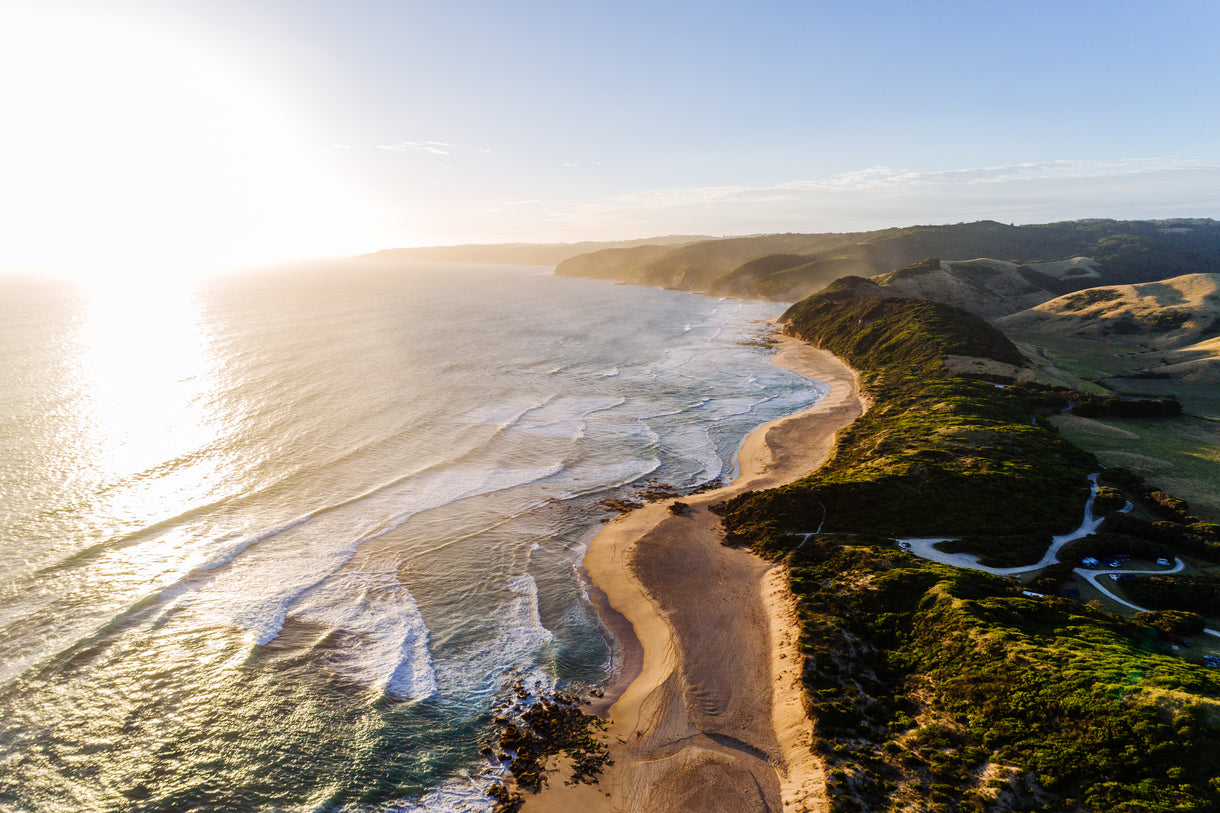


I stood up on the summit of Tititea, the Matterhorn of the south, on a perfect winter’s day back in 2020. To the south and east, my home of Wanaka lay underneath a thick blanket of fog, while looking north I could see the Waiatoto River flowing 60 kilometres down to the Tasman Sea. A trip idea was born — was it possible to use skis and packrafts to traverse this rugged landscape, following the path of a melting water droplet from the glaciers of Tititea, through the wild whitewater of the Waiatoto, and all the way to the ocean?
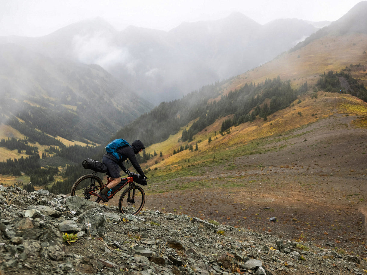
After three years of researching the route and plotting out how we might navigate this unknown terrain, I roped mates Charlie Murray and Jasper Gibson into the idea. The unintentional omission of some key details may have helped; the 30-plus kilograms of gear on our backs, difficult route decisions with technical navigation, and a questionable weather forecast. But they were all in, and in October 2023 we set off for the high country.

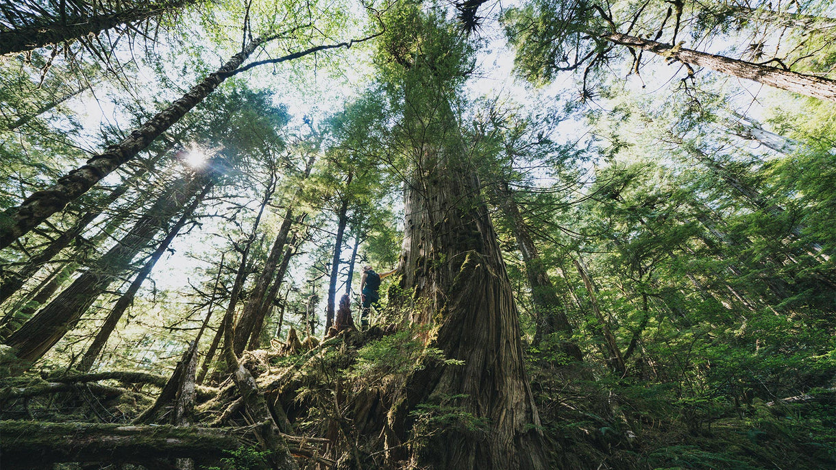
Charlie and Nick preparing to leave the crumbling cathedral of rock and ice that the Volta Glacier has become and begin the long slog down the Waiatoto River. Photo Jasper Gibson
We did the first proper pack of our gear — skis, packrafts, alpine kit, camping stuff, and food — at the trailhead and began tramping up the banks of the Matukituki River. Drizzle loomed over the mountains. I was feeling the effects of a lingering sickness, and we were moving a lot slower than anticipated. We had intended to head straight to Colin Todd Hut via Bevan Col (an alpine pass leading onto the Bonar Glacier), but the combination of weather conditions and fatigue led us to pivot to a slow slog up to French Ridge, arriving at the hut just as snow started falling lightly.

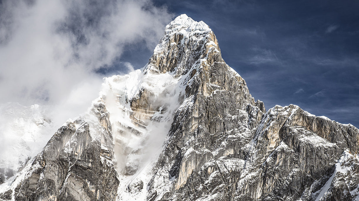
The Therma Icefall Lake is a spectacular and terrifying place, we paused to appreciate it and then got away from the ice and rock fall danger as quickly as we could. Photo Jasper Gibson
We woke to a rare calm morning of quiet and sparkling light, along with ten centimetres of fresh snow. The plan was to head northwest, ski touring toward Quarterdeck Pass, but the peace was broken by our first real problem of the trip — a serious debate around the merits of continuing on at all. If we were exhausted already, how were we going to make it through another six days of unknown terrain, mixed weather, and tight food stores? It was a question nobody could answer decisively, but what we could do was break it into stages and move forward, one step at a time. We could make it to Colin Todd hut (and back again if needed), so why not go that far and reassess? A coin spun through the air to decide our path, and onwards we went.
At Colin Todd, we dug snow from the door and got the billy boiling. A storm was due to roll in early the next morning, so we planned for a dark start. A faint outline of mountains was just visible on the skyline when we set off. As we transitioned from skis to crampons, the first hint of blue light emerged, but our view of the stars soon became sporadic. We crested Therma Col with wispy cloud rolling past and a freezing wind pushing us to seek shelter in the lee of the ridge. Our next step was to traverse a series of glacial benches underneath the northeast ridge of Tititea to reach the Volta Glacier, but we needed good visibility to safely navigate the maze of crevasses, icefall, and moraine. The sunrise was putting on a fiery morning show, but with more snow beginning to fall it became clear we couldn’t continue on safely.
We spent the day back at the hut, watching snow fly past the windows and scrounging from the leftover food box to add to our scarce rations. We rested, got four different weather forecasts, and discussed various backup plans.

Packrafting across the source lake of the Waiatoto River, with Tititea and our route across its glaciers rising into the clouds behind us. Photo Jasper Gibson

Hauling the kitchen sink up French Ridge made for a tough day to start the trip. Photo Jasper Gibson
Next morning we retraced our steps to Therma Col for a second attempt at crossing to the Volta. A thin layer of cloud obscured our view of the valleys below, but it swiftly dropped enough to see the next island of safety. We took our chance to quickly ski under an icefall, and then roped up again to tour to the prow overlooking the hidden Volta Glacier.

Nick, Charlie, and Jasper (left to right) enjoy a peaceful evening at Colin Todd Hut.
The Volta and the Waiatoto River that drains it have bred epic stories of misadventure. While researching the route the immense scale of the challenge became apparent. In 1908 Ebenezer Teichelmann attempted the first ascent of Tititea from the west but, slowed down by rough travel up the Waiatoto, he was stopped in his tracks by the Volta Glacier's icefall which, at that time, extended six kilometres further down the valley. Over the next century, the icefall presented an impenetrable barrier to mountaineers and trampers wanting to link the Volta and the Waiatoto River. Alternate routes were established via Beauty Ridge, Wedge Spur, and through technical climbing up the schist slabs looming above the Waiatoto's source lake.
These days, Aotearoa’s mountain terrain is changing rapidly as climate change impacts glaciers and snowfall. Recent satellite imagery showed us that melting ice and glacial recession may have made the daunting Lower Volta icefall passable, opening up the possibility for us to follow the creekbed from the true source of the river.
A sea of cloud obscured our only route down to the Volta Glacier and stories of misadventure and rescue were front of mind as we ate lunch and debated our options. Charlie felt confident in our ability to stick to the ridge and navigate through the jungle mist, so we skied in a tight group down the prow until we could see a humbling mass of ice and rock below us.

A moment of commitment – skiing onto the Therma Glacier to begin some tricky navigation through cloud and crevasses to the Volta Glacier and the headwaters of the Waiatoto. Photo Jasper Gibson
We’d dropped beneath the cloud and had a clear path to the glacier, but from there it would be an exercise in step-by-step problem solving. The ice was broken and melting, surrounded by unstable fresh moraine walls. There was a small, partially frozen lake at the terminus of the glacier that we needed to cross, so for the first time, we pulled out the drysuits and packrafts. A mixture of pushing through leads — open water channels running through the ice — and rolling over little icebergs got us to the other side with only a little drama, but by this point the nerves had firmly set in. We were in a spectacular mountainous cathedral, but one that had no easy routes out.
This was the true source of the Waiatoto and our planned route was down the river. We passed a remnant ice boulder and began rock hopping beside the still-small creek. The lack of vegetation and topsoil showed how recently our path had been glaciated. We moved quickly, conscious of the fading daylight and overhead rockfall hazard. In front of us lay the Therma Icefall, looming 800 metres above a new lake.
An immense boom broke our rhythm of movement and we stopped to watch the icefall explode into life, sending a cloud of snow and huge ice blocks into the lake below. The only way forward was through that lake. We swallowed our nerves, inflated the packrafts and paddled out, threading our way through the first icebergs and traversing the lake as swiftly as possible. We reached the far side in the fading light and scoped out our camping options.
Navigation was a little tricky. Our actual elevation at the lake was 200 metres below the surface of the glacier shown on our topographical map and our only idea of the terrain was the squashed satellite images we’d come across. Luckily, Jasper stumbled on a small tarn and a vaguely flat spot to pitch the tent. It’d been 15 hours on the go, so we wasted no time making dinner and settling down to sleep.

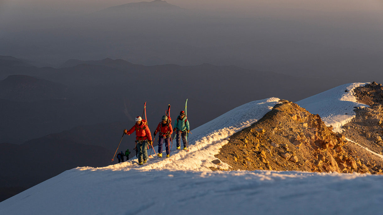
Charlie skis the hanging glaciers on the north side of Tititea, above a sea of cloud that obscured our route down the Waiatoto River. Photo Jasper Gibson
The Therma Icefall boomed into action during the night, waking us twice in shock, and we broke camp at dawn to venture down the valley. On our topo map, this area was still marked as glaciated but what we walked through was a classic alpine New Zealand environment of small shrubs and tussock. We chased a lone chamois as we linked together brushy ledges and gullies of loose rock to descend to the unnamed source lake of the Waiatoto River, which had been formed as the glacier shrunk in the mid-1900s.
We paddled across the lake, taking in the spectacular views back to the summit of Tititea and our unnerving route across the hanging glaciers. After pulling our heavy packs on again at the far side, we had a quick hike down the river flats. Our initial speed lulled us into a false sense of security, which rapidly evaporated when the deer trails disappeared, and our skis began catching on every overhead branch. Our pace dropped right down to about 250 metres an hour. After taking the skis off our packs to throw them through gaps in the bush while we crawled, we decided any other option was preferable. We followed a steep creek, where Jasper set up a quick hip rappel to get us down a small waterfall before we reached the Waiatoto itself. The river was still too steep to packraft, so we boulder-hopped downstream, making camp at the head of the Bonar Flats.
Excitement levels were high the next morning as we pushed the packrafts out into the current. Some fun grade two whitewater followed, before the first of the more difficult grade three and four rapids the Waiatoto is renowned for. These rapids are formed by landslides — the peaks of the Haast Range hang over the narrow valley and periodically release tons of rock that crash down the mountainside, shifting the river's flow.

A mixture of paddling, portaging, and good teamwork ensued. Unfortunately, the previous days’ bush-bashing had claimed a paddle blade as victim, which would have been quite useful with 50 kilometres of river to descend. We alternated paddling canoe-style, which upped the spice level of the rapids, and set up a tow line to even out speeds on the flatwater. After a big day’s paddling, we made our final camp on the flats.
Our last day began with thick morning mist, drizzle, and a cool wind. With a storm on the way and only a couple of muesli bars left to eat between us, it was time to get moving. We navigated a series of fun rapids through a short gorge, and then the Waiatoto turned a sharp corner to head to the ocean. We avoided the dreaded seabreeze headwinds and paddled out into the estuary as raindrops began bouncing off our packrafts. Toes were dipped in the ocean, and we retreated, drenched and satisfied.