Exploring one of the least visited but most revisited national parks in the US, on foot.
From a distance, Isle Royale looks foreboding to travelers. Boreal forest juts up from dark volcanic lakeshore cliffs – the rock near-vertical and the taiga as thick as the morning fog.
Also known by its Ojibwe name, Minong, it is one of the largest islands in a freshwater lake in the world and far away enough from the mainland that it is not often visible. When I first set eyes on the island 15 years ago while sailing Lake Superior’s northern coast, I knew then, as quickly as I have ever known anything, that I wanted to one day step foot on the shore, run the trails and explore the interior.
Isle Royale is located in the northwest corner of Lake Superior, or Gichigami, which means “great sea.” The island is closer to Canada and Minnesota but is designated as a US national park and wilderness area within the state of Michigan. It is only accessible to visitors by boat or seaplane, and the closest urban areas are three to six hours away by car from each of the ports. Because of its remote location and difficult access, Isle Royale consistently ranks among America’s least visited national parks.
Even so, it’s also said to be the most revisited. Isle Royale “certainly gets a hold on people,” one park service employee told me. After years of wondering about the Isle, I finally went this May. But planning a running trip was full of uncertainties. Few runners visit on any given year, making reliable information scarce.
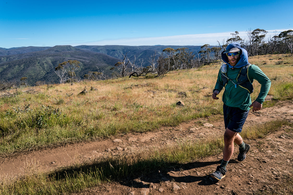
 Running on an ancient bedrock trail at Scoville Point. All photos by Monica Prelle.
The forecast was warm and cool, and wet and dry, and changing every few hours. Though Superior is a lake, its size is more like a mid-sized inland sea. The weather can be fast-moving and unpredictable. When warm air from the land mixes with the colder temperatures of the water, the storms can be violent.
Less than a week before my ferry was scheduled to set sail, I called the visitor’s center to ask a few last-minute questions. Mostly, I wanted to know if the campground shelters were mosquito-proof as I’d hoped to run from camp to camp carrying minimal gear, and Michiganders I knew warned me repeatedly about the bugs. The ranger who answered the phone spent the better part of our short conversation trying to talk me out of the route.
“Running is not recommended,” he said. “You just never know …” His voice trailed off as if he was genuinely concerned.
“That would be an aggressive schedule,” he continued.
The trails are rugged and slow-going, rocky and embedded with roots, he said. Most people walk a mile and a half per hour. Trails aren’t conducive to running and especially not running fast. Rain can make the footing treacherous, and trails are often flooded from beaver dams. A significant storm was in the forecast. And wildlife.
“I guess I could just walk,” I lied.
“Hiking poles are recommended,” he said. “Good luck.”
It was not the first time someone told me that I could not or should not run in a remote wilderness area, but it always gives me pause. In Peru, a guide told me that the trail I wanted to run was impossible, so I hiked. In Japan, a travel agent shook her head when I explained my through-run itinerary. The only way she would book the accommodations was if I said I would walk, so I lied and then ran anyway.
Most of the time when someone tells me I can’t do something, it makes me want to do it more. To prove them wrong, or ultimately—to prove myself right. But this time I doubted my plan, my fitness and myself. I texted a few friends to commiserate.
“You got this!” one running buddy replied with an abundance of silly emojis.
“Don’t let that ranger dissuade you!” wrote another.
I was angry at myself for planning another solo trip and pushing myself out of my comfort zone in a far-flung place, again. I regretted not inviting someone to join me and questioned why I spend so much time alone. But the plan was, in fact, well within my ability. I was not going to let the ranger dissuade me after all.
Even with the reassurance of friends three states away, I was still anxious about the bugs. I had wanted to run with the island’s wolves – which have been reintroduced as of 2018 – but instead, I feared I’d be running from the mosquitos. So, I bought a bug suit and a head net, natural repellent, after-bite anti-itch cream, DEET and more DEET. I packed coils for camp and decided to take a tent after all.
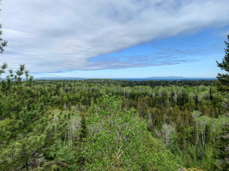 Layers of green and blue, looking north toward Canadian islands.
Long before 1940, when the island archipelago was established as a national park, Indigenous peoples managed the land. Minong, which means “the good place,” is a part of the Grand Portage Band of Lake Superior Chippewa’s cultural property that has provided natural resources for hunting and trapping, maple sugaring, plant and berry gathering, and fishing.
Isle Royale spans 207 square miles. It is 45 miles long by 9 miles wide and has more than 450 smaller surrounding islands. The island is inhabited by a variety of animals, fish and birds: from moose and wolves to eagles, osprey and the northern goshawk as well as the threatened common loon, lake trout, whitefish, pike, duck, geese and waterfowl, plus beavers and red foxes.
White spruce and balsam fir, common boreal forest trees, grow along the rugged coastline, though the warmer climate and deeper soils of the interior provide home to aspens, sugar maples and yellow birch trees. In the summer, grasses and shrubs grow thick and tall.
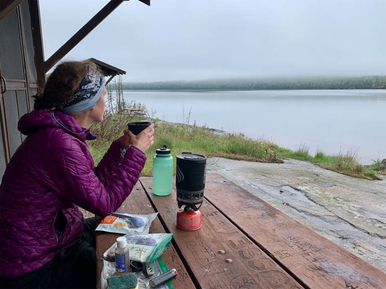 Drinking hot tea at Moskey Basin watching a storm roll out.
Runners who visit during the busy summer months can use ferry and lodging services to run the length of the island on the Greenstone Ridge Trail, which traverses the interior and stays high. And the more adventurous can return on the Minong Ridge Trail along the northern coast. But during my trip, closures due to COVID-19 and minimal early-season services made the route logistically impossible.
Not long after setting up camp on my first night, a storm blew in. Before I saw it, and before it reached me, I could hear it coming. Sitting on the sunny steps of the campground shelter after a short and sticky shakeout run, the roar of the wind rustled the trees. A fisherman casting a line off the dock started running. Within minutes, the temperature dropped 30 degrees and the sunny skies quickly became thick with dark clouds. Heavy rain pounded the shore. Later, as day turned to night, the haunting call of a loon echoed across the bay.
The next morning, I ran from my camp at McCargoe Cove to Todd Harbor along the northern coast, then to the Hatchett Lake Trail and up to the Greenstone Ridge where, from a clearing, I could see the stark contrast of green and blue where the forest meets the big lake.
Once I set foot on the island, everything that felt uncertain shifted to possibility. The unknown became promising. I was happy to be alone, to have time in the wilderness to myself, to just be. I had changed my route three times, but after arriving the only plan was to not get injured or lost. I was on island time, and there wasn’t a mosquito in sight. Instead of a through-route, I opted for a series of base camps and long loop runs.
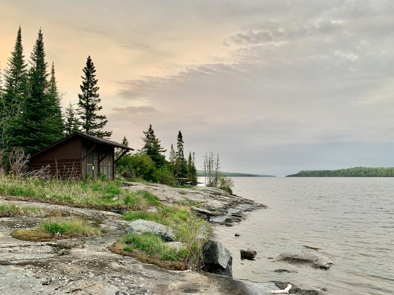 Home for the night—a campground shelter at Moskey Basin.
Isle Royale is a series of ridges and valleys formed by tilted layers of sedimentary and volcanic rock. Wet spots form in the valleys between rock layers where there are lakes, streams and swamps. Many of the trails on the island traverse bedrock, are marked with cairns or cross marshy bogs on planks and boardwalks.
The running had been as slow-going as the ranger had warned, being wet and slippery from the rains, but the ridge trail was mostly bedrock and more arid soil.
Just when I thought I had hit my stride I heard an unfamiliar scream, a loud rapid-fire kek-kek-kek-kek, the high-pitched shrill of a nesting goshawk. As I slowed to a walk, I was pummeled in the back of the head. My hat and sunglasses came off, and I stumbled, falling to my hands and knees.
The northern goshawk is a large and powerful raptor with a relatively short wingspan that still stretches almost four feet. While most hawks soar in wide-open spaces, the goshawk is elusive. It lives under the tree canopy in the forest. They have a long rudder-like tail that allows for quick maneuverability and protective eye tuffs for hunting.
Nesting females can be so aggressive in the spring that they’ve been known to attack their mate. Male goshawks may leave food nearby, rather than approaching the nest. At the time, I had not realised I’d been running near a nest.
“Looking for goshawks is like looking for grace: it comes, but not often, and you don’t get to say when or how,” Helen Macdonald writes in H Is for Hawk.
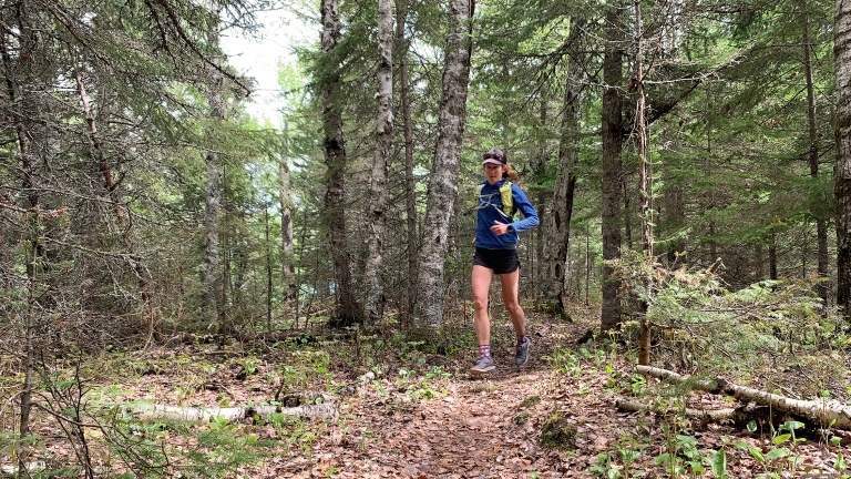 Running through the island’s densely forested interior on the Minong Ridge Trail.
When I stepped off the ferry the day prior, I noticed the wildlife law enforcement boat at the dock was named Goshawk. The warning scream when I ran into the aspen stand was alarming enough to make me slow down. I hadn’t seen it, but as soon I was hit, I knew – Gos. Hawk.
I picked myself up and waited for it to fly off. But it swooped down at me from behind, again, this time without warning. Then, it perched on a snag ahead of me on the trail. The next time, it came at me head-on, and for a moment, I looked directly in the goshawk’s beady eyes. A whoosh of air swept over me as I ducked and covered. It then retreated, presumably, back to its nest.
Running and stumbling with a stick in hand, I looked back every few steps. When I came to a clearing outside of the aspen stand, a pair of backpackers were in the distance. I slowed to a walk, still clutching the limb.
“I’ve learned how you feel more human once you have known, even in your imagination, what it is like to be not,” Macdonald writes. “Goshawks are… to be treasured because what they do has nothing to do with us at all.”
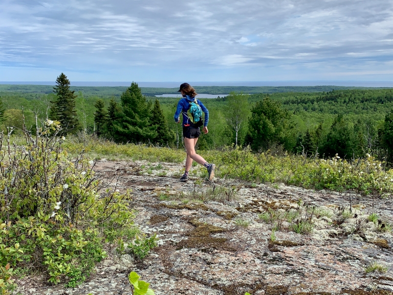 The Greenstone Ridge Trail traverses the length of the island and offers spectacular views.
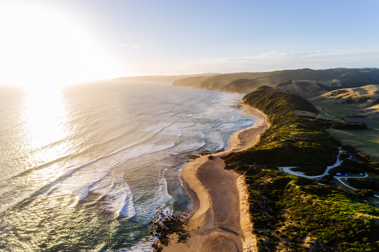
On my final full day on the island, I ran to Scoville Point along the Rock Harbor Trail. It is the farthest eastern point of the island that one can run to on a foot trail. The route is mostly ancient bedrock and relatively easy-going. The views of the eastern islands and the great blue beyond are so spectacular that I often stopped to look around. On the return, I looped back along another section of the Greenstone Ridge Trail, which climbs to over 1,000 feet in elevation to Mount Franklin and the Ojibway Tower, an old fire watch tower that’s the highest point on the eastern end of the island.
Late that night, I woke in my sleeping bag to a bright light. The full moon had broken through a hole in the clouds. I got up out of the shelter and walked the short path to the water. Aspen leaves rustled in the breeze. The wind had calmed in the bay, but the clouds up high were still moving. The moonlight shimmered golden on the water. Soon after, the moon slipped behind the clouds again and I went back to sleep in the quiet dark.
In the morning, as my stove sputtered out of fuel, I drank a cup of almost hot coffee and packed up camp. Leaving Isle Royale, I felt a new and curious calm, as Jim Harrison once wrote about the Michigan woods. Maybe that’s why I run alone in faraway places: in search of that calm. After first seeing the island many years ago, it had become a faraway place of distant dreams, but once I had spent six days running there, it seemed both less and more mysterious. There’s nothing like running on an island in the biggest freshwater lake in the world where you can sleep near the sound of water lapping at the shore, listen to the call of the loon and look a goshawk in the eyes.
That is why so many people go back. It’s mesmerising and relaxing. Tranquil and energising. And truly wild. To run there is to be humbled. I departed for the mainland feeling grateful, vowing to return.
Banner Image: A storm lifting over Moskey Basin, Isle Royale, Lake Superior.
____________________________________________________________________
Author Profile

Monica Prelle


